

CEMETERIES
Mapping data from USGS GNIS
There may be duplicate entries for cemeteries, and some cemeteries may overlap township lines.
Cemetery Name & Transcription Link |
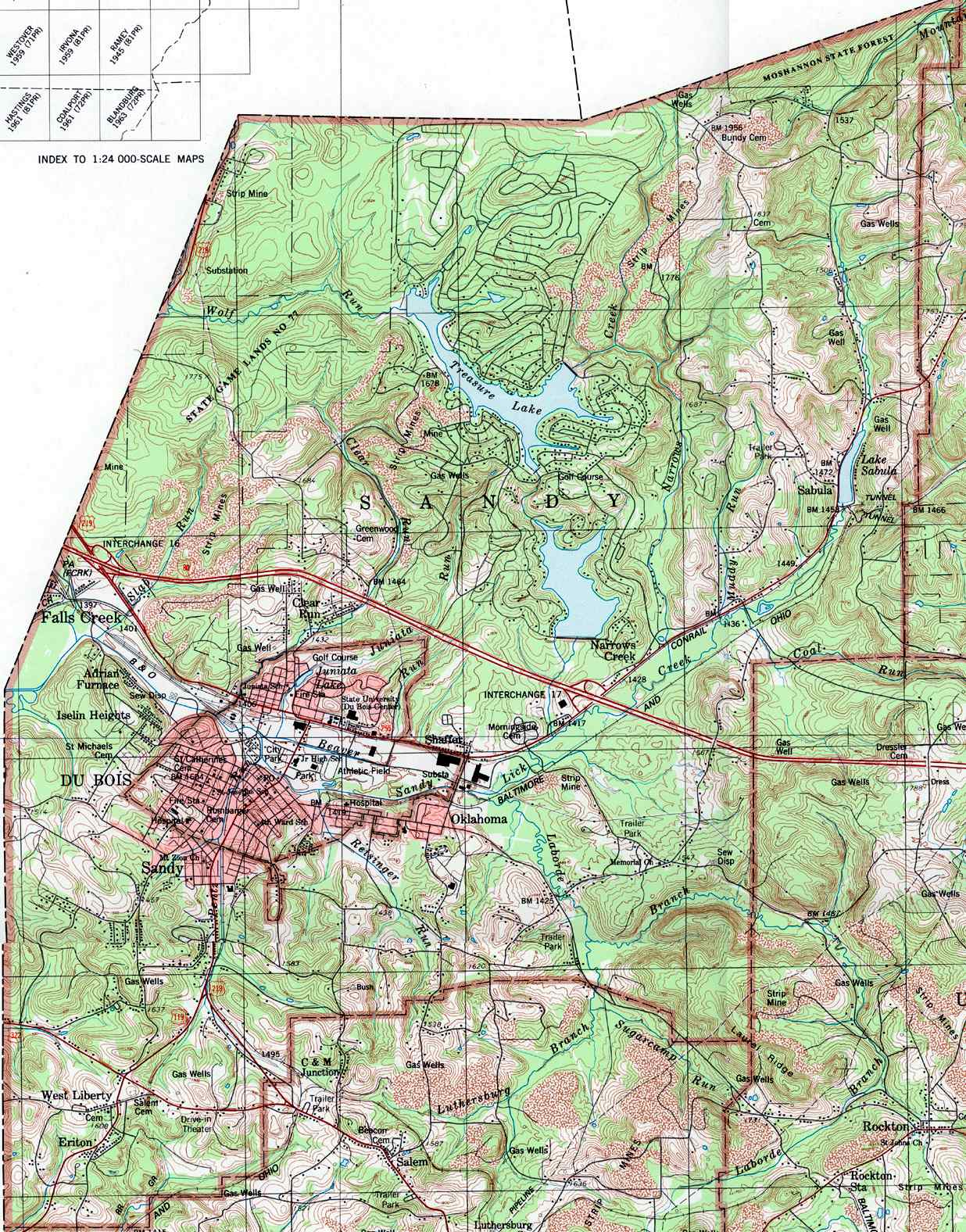
Map |
Photos |
USGS ID |
Latitude |
Longitude |
USGS TOPO Map |
Township/Borough |
| African-American Cemetery (aka old John Crain farm) | Decatur | ||||||
| Alexander | Map | Photos | 1213569 | 405000N | 0782510W | Ramey | Bigler |
| Allemansville (aka Oak Grove Church Cemetery) | Map | 2801551 | 404348N | 0782429W | Blandburg | Gulich | |
| Allport | Map | 2800144 | 405830N | 0781157W | Philipsburg | Morris | |
| American Legion Cemetery | Map | 2798838 | 404933N | 0782110W | Houtzdale | Borough of Brisbin | |
| Anderson Creek Graveyard | Pike | ||||||
| Anthonys Lithuanian Cemetery | 40.8637720 | -78.2667510 | Borough of Osceola Mills | ||||
| Ashcroft | Map | 2800535 | 405531N | 0781226W | Philipsburg | Morris | |
| Banner Ridge | Map | 2798601 | 405247N | 0784129W | Mahaffey | Bell | |
| Baughman | Map | 1168817 | 405319N | 0782346W | Glen Richey | Decatur | |
| Baughman | Map | 2800506 | 405243N | 0781910W | Wallaceton | Woodward | |
| Beatty | Bell | ||||||
| Beatty Cemetery | Sandy | ||||||
| Bedford | Boggs | ||||||
| Bell Cemetery (aka Glen Hope Cemetery or Wright Cemetery) | Map | 2799528 | 404752N | 0782939W | Ramey | Borough of Glen Hope | |
| Bell Family | Ferguson | ||||||
|
Beulah |
Map | 1213561 | 404835N | 0782401W | Ramey | Gulich | |
| Bigler | Map | 2800514 | 405909N | 0781805W | Wallaceton | Bradford | |
| Bish | Huston | ||||||
| Bloom Cemetery | Bigler | ||||||
| Bloomington | Map | 2799251 | 405606N | 0783108W | Curwensville | Pike | |
| Bradford Cemetery (aka Old Bradford Church Cemetery) | Map | 2800492 | 410024N | 0782058W | Lecontes Mills | Bradford | |
| Bridgen Cemetery (aka Old Oak Hill Cemetery) | Karthaus | ||||||
| Buck's Farm Cemetery | Bradford | ||||||
| Bundy | Map | 1170667 | 411132N | 0783616W | Penfield | Huston | |
| Bundy | Map | 1170668 | 411158N | 0784116W | Sabula | Sandy | |
| Burnside | Map | 2800215 | 404836N | 0784725W | Burnside | Burnside | |
| Calvary | Map | 1170917 | 404905N | 0782501W | Ramey | Bigler | |
| Calvary (Catholic Cemetery) | Map | 1170919 | 410021N | 0782550W | Clearfield | Lawrence | |
| Camp Corbly | Pike | ||||||
| Casper Hockenberry Family | Ferguson | ||||||
| Catholic Cemetery | Sandy | ||||||
| Center Hill | Map | 1213552 | 405816N | 0781515W | Wallaceton | Graham | |
| Centre Methodist Episcopal | Lawrence | ||||||
| Centre United Methodist Cemetery (aka Centre Cemetery) | Map | 1213541 | 405258N | 0781706W | Wallaceton | Decatur | |
| Chestnut Grove United Methodist | Map | 279957 | 410118N | 0783850W | Luthersburg | Bloom | |
| Church of the Good Shepherd | Morris | ||||||
| Clark Cemetery (aka Patchinville Cemetery) | Burnside | ||||||
| Clover Run Cemetery (aka Mount Carmel Cemetery) | 40.9343000 | -78.7809000 | Bell | ||||
| Congress Hill | Map | 1172328 | 410437N | 0781551W | Lecontes Mills | Girard | |
| Congress Hill | Goshen | ||||||
| Conway | Map | 1172376 | 411136N | 0783817W | Sabula | Huston | |
| Cooper | Cooper | ||||||
| County Home Cemetery | Map | 2799124 | 410130N | 0782432W | Clearfield | Borough of Clearfield | |
| Criswell | Map | 1172704 | 404416N | 0782408W | Blandburg | Gulich | |
| Cross | Map | 1172737 | 405149N | 0783809W | Westover | Ferguson | |
| Crossroads | Map | 1213557 | 404702N | 0782757W | Ramey | Beccaria | |
| Crowell Farm Cemetery | Decatur | ||||||
| Crown Crest Memorial Park | Map | 1172776 | 405942N | 0782805W | Glen Richey | Lawrence | |
| Curly Hurd | Chest | ||||||
| Dale Methodist Episcopal | Map | 2798710 | 410044N | 0781749W | Lecontes Mills | Bradford | |
| Dressler | Map | 1173471 | 410723N | 0783921W | Luthersburg | Union | |
| Dunkard | Map | 2799125 | 404738N | 0784110W | Westover | Burnside | |
| Dunkard | Chest | ||||||
| East Ridge | Map | 2801318 | 404347N | 0784328W | Hastings | Burnside | |
| Eden | Map | 2798785 | 410629N | 0782037W | Lecontes Mills | Goshen | |
| Egypt Cemetery | Map | 2800344 | 410327N | 0781955W | Lecontes Mills | Bradford | |
| Emmanuel - Boone Mountain Cemetery (aka Pine Grove Cemetery) | Map | 2801529 | 411122N | 0784057W | Sabula | Sandy | |
| Evangelical United Brethren | Map | 2801496 | 410122N | 0784709W | Du Bois | Brady | |
| Evangelical United Brethren | Burnside | ||||||
| Fairview Cemetery | 40.7970000 | -78.619700 | Borough of LaJose (aka Newburg) | ||||
| Fairview Church Cemetery | Graham | ||||||
| Fairview (aka Heberling Cemetery and West Liberty Cemetery) | 41.0802400 | -78.783630 | Sandy | ||||
| Fairview Baptist | Chest | ||||||
| Fairview United Methodist Cemetery | Morris | ||||||
| Ferguson | Map | 1174687 | 405524N | 0783256W | Curwensville | Ferguson | |
| Forest Baptist | Map | 2799134 | 405757N | 0780936W | Philipsburg | Cooper | |
| Fox Family Cemetery | Map | 2800543 | 404349N | 0782215W | Tipton | Gulich | |
| Frenchville Cemetery | Covington | ||||||
| Friends | Map | 1175253 | 405726N | 0783612W | Curwensville | Penn | |
| Fruit Hill | Map | 2799611 | 405120N | 0783232W | Irvona | Jordan | |
| Fulton | Map | 1175331 | 410143N | 0782307W | Clearfield | Lawrence | |
| Gaines | Bradford | ||||||
| Gazzam Cemetery | Bradford | ||||||
| Gelnett | Sandy | ||||||
| Gillingham | Map | 2799578 | 410706N | 0781847W | Lecontes Mills | Girard | |
| Ginter Cemetery | Map | 2800533 | 404517N | 0782337W | Ramey | Gulich | |
| Glen Richey | Lawrence | ||||||
| Goshen Methodist Episcopal | Map | 2798523 | 410452N | 0782339W | Clearfield | Goshen | |
| Goss | Map | 1213549 | 405455N | 0782016W | Wallaceton | Decatur | |
| Goss | Map | 280081 | 405144N | 0781548W | Houtzdale | Borough of Osceola Mills | |
| Graham Farm Burial | Woodland | ||||||
| Grandview Cemetery (aka Emigh Cemetery) | Map | 1174220 | 405641N | 0781404W | Philipsburg | Morris | |
| Grassflat Lanse Lutheran Cemetery | Map | 2800020 | 410012N | 0780710W | Karthaus | Cooper | |
| Greek Orthodox Cemetery | Borough of Ramey | ||||||
| Greenlawn Cemetery | Sandy | ||||||
| Greenville Church of the Brethren | Map | 2801393 | 410040N | 0783616W | Elliott Park | Bloom | |
| Greenwood | Map | 1176196 | 410901N | 0784454W | Sabula | Sandy | |
| Harmony | Map | 2801964 | 404654N | 0784344W | Westover | Burnside | |
| Harmony Chapel | Map | 2798778 | 404622N | 0783657W | Irvona | Chest | |
| Henderson | Map | 1213568 | 405139N | 0782259W | Ramey | Borough of Ramey | |
| Hewitt Cemetery (aka Mill Run Cemetery) | Huston | ||||||
| Hillcrest Cemetery (aka New Clearfield Cemetery & Clearfield Cemetery) | Map | 1177089 | 410135N | 0782554W | Clearfield | Lawrence | |
| Hockenberry | Bigler | ||||||
| Holy Trinity Catholic | Map | 2800248 | 404742N | 0782341W | Ramey | Gulich | |
| Holy Trinity Lutheran | Cooper | ||||||
| Home Side Cemetery | Borough of Newburg | ||||||
| Hoyt | Huston | ||||||
| Hoyt | Sandy | ||||||
| Hunter | Map | 1177606 | 405838N | 0781135W | Philipsburg | Morris | |
| Hunter | Map | 1182300 | 405839N | 0781135W | Philipsburg | Morris | |
| Immaculate Conception | Decatur | ||||||
| Immaculate Conception | Borough of Grampian | ||||||
| Immaculate Conception | 40.7220910 | -78.4269330 | Bigler | ||||
| Immanuel | Map | 1177708 | 405757N | 0780924W | Philipsburg | Cooper | |
| Independent Order of Odd Fellows | Map | 1213528 | 405017N | 0782127W | Houtzdale | Woodward | |
| Irvin Cemetery - 1st Cemetery in Clearfield County | Pike | ||||||
| Janesville Cemetery (aka Jubos Cemetery) | Union | ||||||
| Jewish | Sandy | ||||||
| John Crowell Family | Decatur | ||||||
| John Hockenberry | Ferguson | ||||||
| Johnson Cemetery | Greenwood | ||||||
| Joy - Olanta | Knox | ||||||
| Keagy Cemetery | Covington | ||||||
| Keagy | 40.8181000 | -78.4708010 | Bigler | ||||
| Keewaydin | Map | 2800021 | 410617N | 0780911W | Frenchville | Covington | |
| Kephart | Decatur | ||||||
| Kirk | Penn | ||||||
| Kooker | Map | 1178643 | 411429N | 0783251W | Penfield | Huston | |
| Kroh Cemetery | Clearfield County | ||||||
| Kylertown Presbyterian Cemetery (aka Kyler Cemetery) | Map | 1178725 | 405929N | 0781000W | Philipsburg | Bigler | |
| LaJose | Map | 1178737 | 405007N | 0784108W | Westover | Borough of Newburg (aka LaJose) | |
| Lanse Evangelical Free | Cooper | ||||||
| Laurel Run | Map | 1179022 | 410952N | 0783144W | Penfield | Huston | |
| Lithuanian | Decatur | ||||||
| Litz-Hess Cemetery | Borough of Clearfield | ||||||
| Livingston | Bradford | ||||||
| Lumber City | Map | 2800142 | 405545N | 0783506W | Curwensville | Ferguson | |
| Luthersburg Reformed | Brady | ||||||
| Luthersburg Union Cemetery | Map | 2799352 | 410317N | 0784325W | Luthersburg | Brady | |
| Lyleville (aka Shelton Hill Cemetery; Coalport Cemetery; Chelton Hill & Beers Cemetery) | 40.7351800 | -78.5396500 | Beccaria | ||||
| Mahaffey | Map | 1180200 | 405213N | 0784300W | Westover | Bell | |
| McClure | Map | 1180638 | 405720N | 0783234W | Curwensville | Pike | |
| McGonical | Karthaus | ||||||
| McKee | Knox | ||||||
| McLaughlin Cemetery | Clearfield County | ||||||
| McMasters Family Cemetery (aka Rabbit Hill Cemetery) | 40.7957480 | -78.6320690 | Chest | ||||
| McNaul | Map | 2800401 | 405922N | 0783210W | Curwensville | Pike | |
| McNeel Run Cemetery | Ansonville | Jordan | |||||
| McPherron Church Cemetery | Map | 2800402 | 404636N | 0783652W | Irvona | Chest | |
| Messiah Baptist | Map | 2800345 | 405912N | 0780839W | Philipsburg | Cooper | |
| Methodist on Ridge | Bigler | ||||||
| Millstone (Abandoned) | Bradford | ||||||
| Moke's Hill aka Mock's Hill | Map | 1213546 | 405517N | 0781607W | Wallaceton | Boggs | |
| Morningside | Map | 1181563 | 410732N | 0784314W | Sabula | Sandy | |
| Morrisdale Cemetery | Morris | ||||||
| Mount Carmel Cemetery (aka Clover Run Cemetery) | Map | 2798524 | 405604N | 0784652W | McGees Mills | Bell | |
| Mount Joy | Map | 2798885 | 410316N | 0782608W | Clearfield | Lawrence | |
| Mount Joy United Brethren in Christ | Map | 2801493 | 404742N | 0784341W | Westover | Burnside | |
| Mount Pleasant (Formerly Known As Ball Cemetery) | Beccaria | ||||||
| Mount Pleasant Cemetery (aka Lee Cemetery) | Map | 1181805 | 411412N | 0783436W | Penfield | Huston | |
| Mount Zion | Map | 2799126 | 410211N | 0782850W | Clearfield | Lawrence | |
| Mount Zion Independent Church Cemetery (aka Mount Zion Cemetery) | 40.8337040 | -78.7255800 | Borough of Mahaffey | ||||
| Mount Zion Memorial | Knox | ||||||
| Mount Zion Memorial | Map | 1213529 | 405433N | 0782856W | Glen Richey | Burnside | |
| Murray | Map | 1182104 | 410459N | 0781624W | Lecontes Mills | Girard | |
| Nativity of St John the Baptist Orthodox | Decatur | ||||||
| Nativity of the Virgin Mary Orthodox | Map | 2800534 | Houtzdale | Decatur | |||
| New | 405838N | 0781135W | Borough of Clearfield | ||||
| New Allport | 40.9751000 | -78.1986000 | Morris | ||||
| New Millport | Map | 2800249 | 405350N | 0783236W | Curwensville | Pike | |
| New Washington | Map | 2801196 | 404935N | 0784221W | Westover | Burnside | |
| New West Liberty Cemetery (aka Fairview Cemetery &Heberling Cemetery) | Sandy | ||||||
| Oak Grove Church Cemetery | Gulich | ||||||
| Oak Hill Memorial | Map | 2799127 | 410904N | 0780716W | Pottersdale | Karthaus | |
| Oak Hill | Map | 1182772 | 405847N | 0783135W | Curwensville | Pike | |
| Oklahoma | Map | 2801530 | 410652N | 0784353W | Luthersburg | Sandy | |
| Old | Map | 1182904 | 405802N | 0781200W | Philipsburg | Morris | |
| Old Allport (aka Old Cemetery) | Morris | ||||||
| Old Bundy | Huston | ||||||
| Old Clearfield | Map | 2801015 | 410127N | 0782552W | Clearfield | Lawrence | |
| Old Goss Cemetery | Boggs | ||||||
| Old Oak Hill | Karthaus | ||||||
| Old Perks | Morris | ||||||
| Old Saint Francis Catholic | Lawrence | ||||||
| Old Swedish | Jordan | ||||||
| Old Town | Pike | ||||||
| Old Union | Brady | ||||||
| Old West Liberty | Map | 2799074 | 410439N | 0784714W | Du Bois | Sandy | |
| Old Zion Baptist | Jordan | ||||||
| Otterbein | Map | 2801250 | 405348N | 405348N | McGees Mills | Bell | |
| Owens Cemetery (aka Goshen Methodist Cemetery) | Map | 1183149 | 410057N | 0782514W | Clearfield | Lawrence | |
| Palestine | Map | 2799548 | 410125N | 0781316W | Graham | ||
| Paradise Cemetery | Sandy | ||||||
| Patchinville Cemetery | Map | 280039 | 404643N | 0784631W | Burnside | Burnside | |
| Peale Cemetery | Cooper | ||||||
| Penfield | Map | 2800398 | 411241N | 0783432W | Penfield | Huston | |
| Perks Cemetery | Map | 2801197 | 405537N | 0781419W | Philipsburg | Morris | |
| Pine Grove Bethel Cemetery | Map | 2799542 | 405839N | 0782710W | Glen Richey | Lawrence | |
| Pine Grove - Sabula (aka Emmanuel-Boone Mountain Cemetery) | Sandy | ||||||
| Plainview | Pike | ||||||
| Pleasant Hill United Methodist Church Cemetery | Map | 2801501 | 410022N | 0780748W | Frenchville | Morris | |
| Reidy | Map | 2801963 | 405725N | 0781653W | Wallaceton | Boggs | |
| Rock Springs | Map | 1185297 | 405719N | 0784414W | Mahaffey | Bell | |
| Rockton | Map | 2799128 | 410439N | 0783857W | Luthersburg | Union | |
| Ross | Girard | ||||||
| Rumbarger | Map | 1185611 | 410657N | 0784626W | Du Bois | Sandy | |
| Sabin - Ellis Cemetery | Map | 2799547 | 405242N | 0784400W | Mahaffey | Borough of Mahaffey | |
| Sabula Methodist | Sandy | ||||||
| Sacred Heart Catholic - Slovak | Map | 2800544 | 405016N | 0782128W | Houtzdale | Woodward | |
| Saint Agnes | Map | 1185731 | 405641N | 0781408W | Philipsburg | Morris | |
| Saint Barbara | Map | 1213563 | 404843N | 0782318W | Ramey | Woodward | |
| Saint Barbara | Map | 2798982 | 405019N | 0782134W | Houtzdale | Decatur | |
| Saint Basil | Map | 1185814 | 404603N | 0783223W | Irvona | Beccaria | |
| Saint Bonaventure | Map | 1185836 | 405809N | 0783737W | Mahaffey | Penn | |
| Saint Catherine of Siena | Map | 1185855 | 410719N | 0784641W | Du Bois | Sandy | |
| Saints Cyril and Methodius Roman Catholic Cemetery | Cooper | ||||||
| St. Francis Catholic Cemetery - New | Lawrence | ||||||
| St. Francis Catholic Cemetery - Old | Lawrence | ||||||
| Saint John the Baptist Byzantine | Morris | ||||||
| Saint John The Baptist Orthodox Greek | Map | 2798711 | 405539N | 0781208W | Philipsburg | Morris | |
| Saint John's Lutheran | Munson | Cooper | |||||
| Saint Johns | Map | 1186073 | 405312N | 0781418W | Philipsburg | Decatur | |
| Saint Joseph | Map | 1213526 | 405127N | 0781642W | Houtzdale | Decatur | |
| Saint Joseph | Map | 1186224 | 410722N | 0784655W | Du Bois | Sandy | |
| Saint Joseph's Catholic | Decatur | ||||||
| St. Lawrence Catholic (aka Irish Cemetery) | Map | 2800491 | 404921N | 0782136W | Houtzdale | Woodward | |
| Saint Lukes United Church of Christ Cemetery (aka Luthersburg Reformed Cemetery) | Map | 2800490 | 410259N | 0784314W | Luthersburg | Brady | |
| Saint Mary's Annunciation Ukranian | Map | 2800256 | 410616N | 0781256W | Frenchville | Gulich | |
| Saint Mary's Orthodox | Map | 1213562 | 404827N | 0782353W | Ramey | Bigler | |
| Saint Marys Nativity of the Theotokos Churchyard | Bigler | ||||||
| Saint Michael | Map | 1186481 | 410722N | 0784707W | Du Bois | Sandy | |
| Saint Michaels | Map | 1186479 | 404612N | 0783333W | Irvona | Beccaria | |
| Saint Pauls | Map | 1186564 | 404545N | 0783215W | Irvona | Beccaria | |
| Saint Peter and Paul Catholic Church Cemetery | Map | 2800082 | 405946N | 0780736W | Philipsburg | Cooper | |
| Saints Peter and Paul | Map | Morris | |||||
| Saint Severins | Map | 1186714 | 410153N | 0780634W | Karthaus | Cooper | |
| Saint Vladimir's Ukrainian Orthodox | Map | 2801130 | 404831N | 0782359W | Ramey | Gulich | |
| Salem | Map | 1186810 | 410448N | 0784700W | Du Bois | Sandy | |
| Salem Lutheran Church Cemetery | Map | 2799541 | 410202N | 0784535W | Du Bois | Sandy | |
| Salem Methodist | Map | 2799353 | Luthersburg | Brady | |||
| Sanborn | Map | 1213531 | 405408N | 0782355W | Glen Richey | Woodward | |
| Schmoke Cemetery | Pottersdale | Karthus | |||||
| Schofield Grave Site | Penn | ||||||
| Shaw Burial Ground | Map | 2799557 | 410112N | 0782648W | Clearfield | Borough of Clearfield | |
| Shawville | Map | 2801061 | 410408N | 0782132W | Lecontes Mills | Goshen | |
| Shelton Hill Cemetery (aka Beers Cemetery, Coalport Cemetery, or Lyleville Cemetery | Map | 1209247 | 404405N | 0783225W | Coalport | Beccaria | |
| Shepherd | Burnside | ||||||
| Shiloh | Map | 1187517 | 410304N | 0781727W | Lecontes Mills | Bradford | |
| Shubert Family | Pike | ||||||
| Smith Cemetery | Bell | ||||||
| Snyder | Map | 1187951 | 405422N | 0783127W | Curwensville | Pike | |
| Sons of Israel | Map | 2801552 | 410723N | 0784645W | Du Bois | Sandy | |
| Spangle | Map | 1188145 | 404506N | 0783228W | Irvona | Beccaria | |
| Spring Valley United Methodist | Map | 2800399 | 405812N | 0782117W | Wallaceton | Boggs | |
| Stewart | Map | 1188645 | 410112N | 0782114W | Lecontes Mills | Bradford | |
| Stoneville | Map | 1188750 | 405821N | 0782333W | Glen Richey | Boggs | |
| Summit Hill Church Cemetery | Graham | ||||||
| Summit Hill | Map | 2800355 | 405752N | 0781503W | Wallaceton | Morris | |
| Sunderland | Map | 1193499 | 405045N | 0784657W | Burnside | Bell | |
| Sylvan Grove | Map | 2800513 | 410113N | 0780945W | Frenchville | Cooper | |
| Thompson | Map | 1189497 | 405716N | 0782814W | Glen Richey | Lawrence | |
| Troutville Amish Cemetery (aka Amish Cemetery | Borough of Troutville | ||||||
| Troutville Union Cemetery (aka Union Cemetery) | Map | 1190115 | 410159N | 0784611W | Du Bois | Sandy | |
| Troutville United Church Cemetery (aka Troutville Reformed Cemetery & Troutville Trinity United Church of Christ Cemetery) | Map | 2800255 | 410113N | 0784722W | Du Bois | Brady | |
| Umbria | Map | 2800216 | 405133N | 0781615W | Houtzdale | Decatur | |
| United Brethren in Christ Cemetery | Map | 2799962 | 404716N | 0784649W | Burnside | Burnside | |
| United Church of Christ | Brady | ||||||
| Utahville | Map | 2800022 | 404426N | 0782812W | Blandburg | Beccaria | |
| Wallaceton Cemetery | Borough of Wallaceton | ||||||
| Watts | Map | 1190700 | 405429N | 0783649W | Curwensville | Greenwood | |
| Wayne | Sandy | ||||||
| Weld | Map | 1190803 | 404528N | 0782927W | Ramey | Beccaria | |
| Westover Baptist | Map | 2800497 | 404509N | 0783958W | Westover | Chest | |
| Williams | Map | 1191458 | 405423N | 0783247W | Curwensville | Pike | |
| Williams | Ferguson | ||||||
| Winburne Catholic Cemetery | Cooper | ||||||
| Winburne Presbyterian Church Cemetery | Map | 2798917 | 405814N | 0780834W | Philipsburg | Cooper | |
| Woods | Map | 1191760 | 405931N | 0783741W | Mahaffey | Bloom | |
| Zion | Map | 1191963 | 405035N | 0783534W | Irvona | Beccaria |
