.jpg)
Clearfield County, Pennsylvania


.gif)
|
County Maps |
|
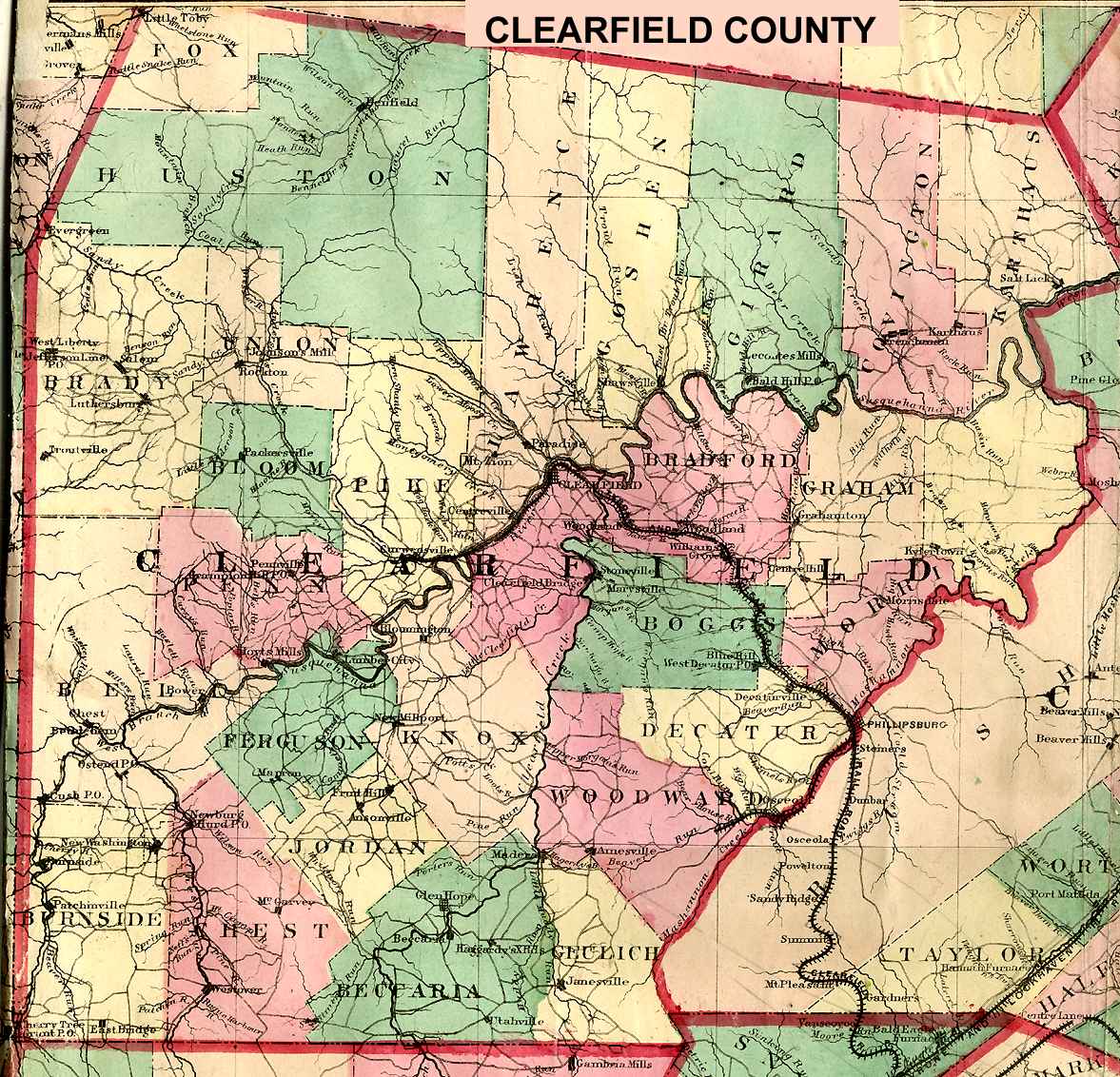
Clearfield County - 1866 , A. Pomeroy |
|
Clearfield County Clickable USGS Township Map* (topographic) - includes maps of boroughs and villages |
|
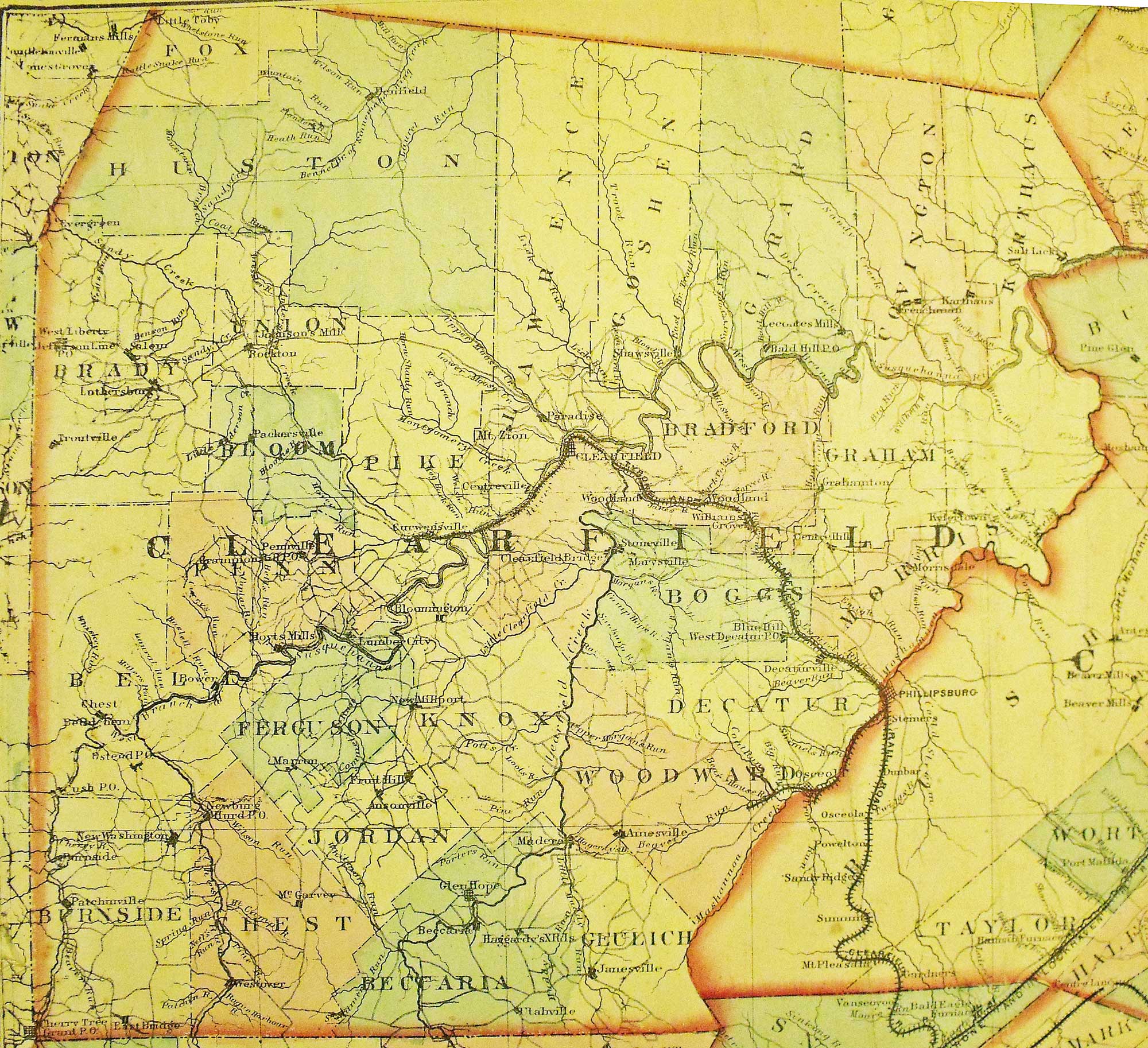
Clearfield County 1873 Map, contributed by Ellis Michaels |
|
Township Maps |
|
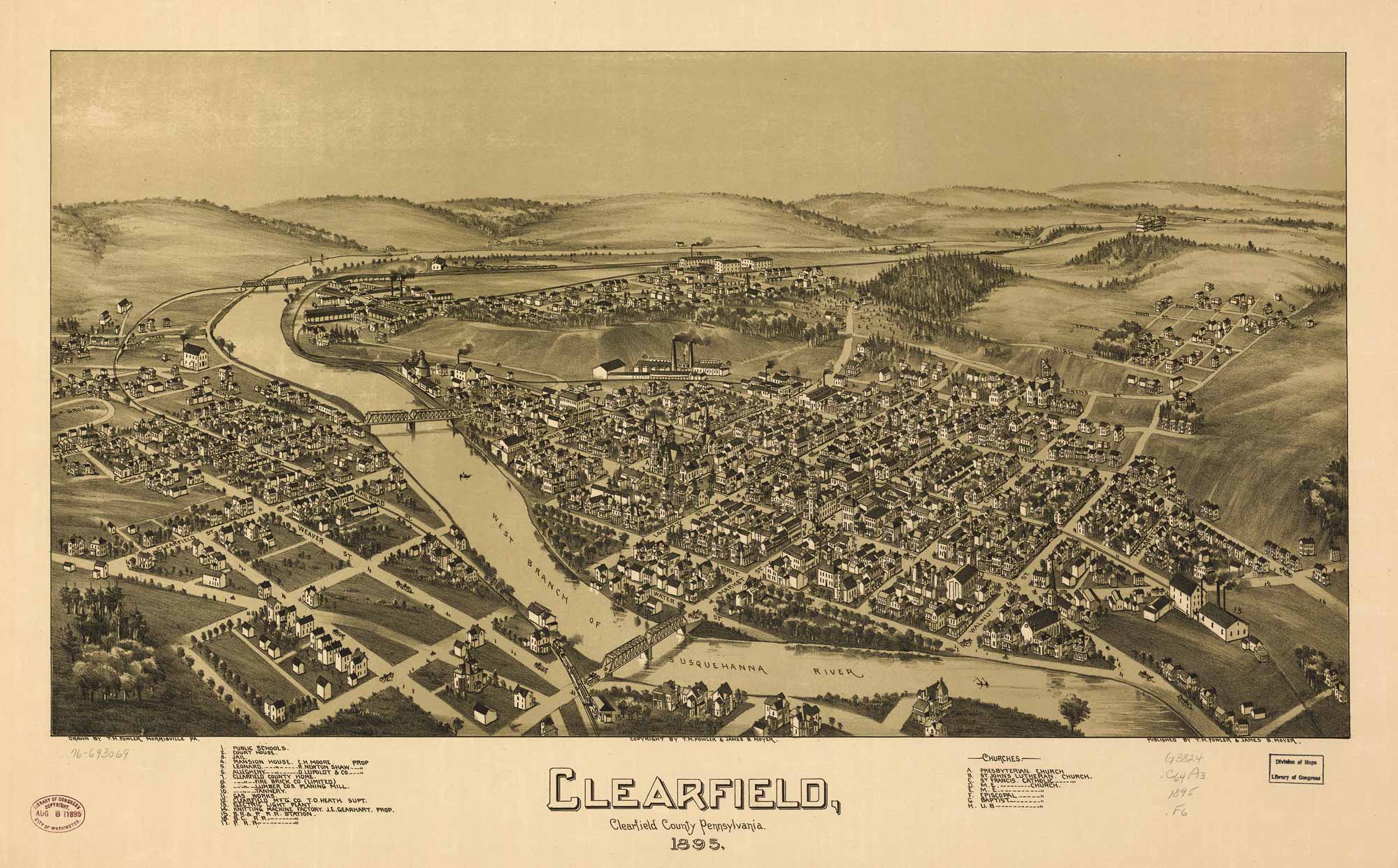
Clearfield Borough - 1895, Library of Congress |
|
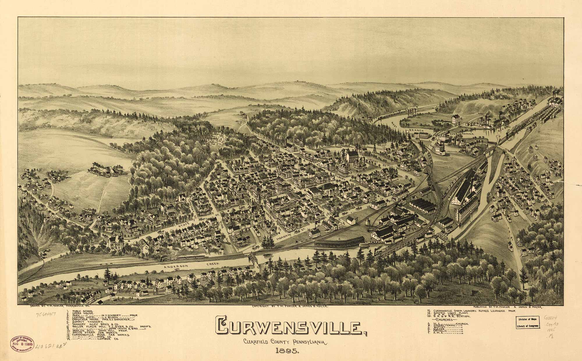
Curwensville Borough - 1895, Library of Congress |
|
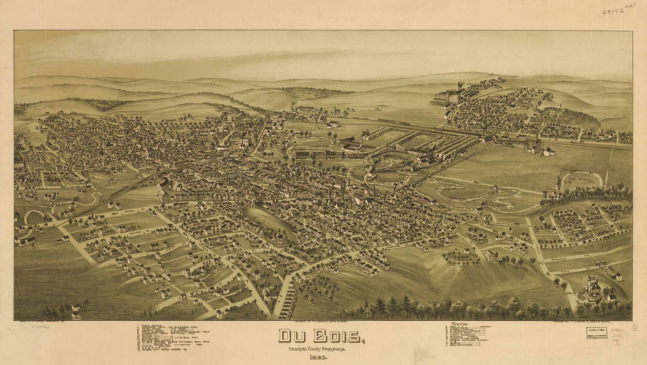
DuBois Borough - 1895, Library of Congress |
|
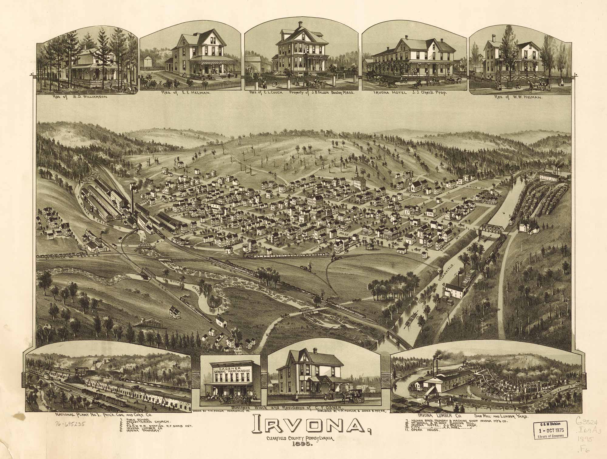
Irvona Borough - 1895, Library of Congress |
|
Sandborn Fire Insurance Maps |
*Part of the USGenWeb Archives, United States Digital Map Library
|
PAGenWeb State Coordinator PAGenWeb Assistant State Coordinator/County Coordinator (Eastern Counties) |
Clearfield County Coordinator Linda J. East |
Assistant County Coordinator |
 All copyright laws are observed to the best of our ability.
However if you feel something is on the site and infringes on copyright laws let us know. Use of information is for Personal Genealogical purposes only.
Commercial publication of any such information is prohibited. All text and images are copyright by said contributors.
© 2024 Clearfield County PAGenWeb Project
This page was last updated
3 Jan 2024